Sunday, October 17, 2010

Oct 4-8 Arcata CA.

We drove along the coast (more spectacular scenery) to arrive at Mad River Campground in Arcata.

The coast

Our campsite at Mad River

Our first excursion—an all day one—was to the Avenue of the Giants to see redwood trees. They were amazing—majestic and humbling.


The next day we stayed closer to home and visited the Arcata Marsh and Wildlife Sanctuary. You can’t tell by looking at the following picture, but the whole sanctuary is a waste water treatment facility!


We also drove to Samoa and Ray wandered out on the Jetty (despite the signs). It was nowhere near high tide so he felt safe.


The jetty


On the following day we dared a tsunami hazard area to see the Pacific Ocean from the California coast.


That's the Pacific Ocean behind me.

Wow, we have made it to the California coast! You could say that when we leave Arcata, we will be starting the journey home...

Wednesday, October 6, 2010

RAY’S RANDOM RAMBLINGS III – OCTOBER 2010

For the number-crunchers in our group, after five months on the road we have added over 11,800 miles to the truck. With a combined towing and touring average of around 15 MPG, we have sucked up about 780 gallons of diesel fuel. If you estimate the cost of diesel at about $3.10 per gallon, you can do the rest of the math – with or without the assistance of some electronic device - to calculate the total fuel cost.

As many of you know, I believe you should always use an electronic device whenever it is within reach. I am reminded of the time when the moral dilemma on campus was whether or not a slide rule could be used during an exam. My thinking has always been “why waste time and brain power confirming what is already known”? If your goal is to explore and conquer the unknown, then you should move as quickly as possible through the known, using whatever mechanical device makes that possible.

The purist argument in the slide rule debate was that if the slide rule was broken or not available, humans might have to rely entirely on their brain. If we fast forward fifty years and apply the same logic to today’s way-more-advanced technology, than the question becomes whether or not I can use my laptop or iPhone. My response is of course the same, use technology.

If an electronic aid is not available to me, then I must be in some truly remote part of the world, where it really doesn’t matter if my hut has a perfect right angle. Or, it means we are all starting over, in which case we would need to reserve our brain power for far more urgent issues, such as how to get coconuts down from a very tall tree.

So, what does a moral dilemma have to do with recounting and recording our RV journey of a lifetime? Absolutely nothing; but, that is what is called “editorial privilege” – and precisely why this section of the blog is referred to as “Ray’s Ramblings”

I continue to have a wonderful time on our journey. I am certain that Debby is too because the other day we met a couple at a cocktail lounge and Deb asked them “Do you want to come to our house and play some Hearts?” Our HOUSE!!??? That is the way she and I both think of our portable home – with less than 300 square feet of living space.

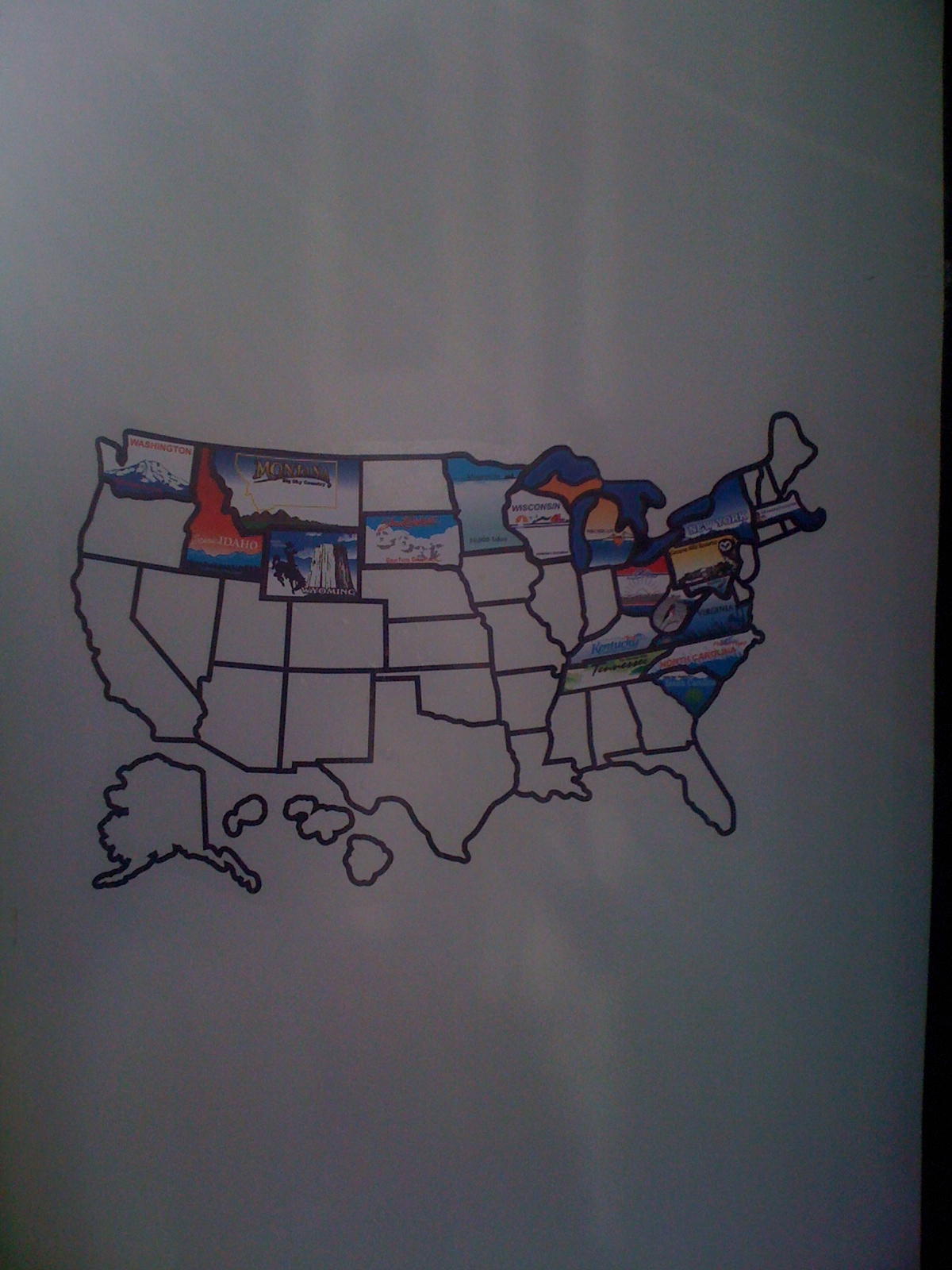
We are having so much fun that the trip will very likely extend into a full year – or more. We have too much of this great country yet to see. I am constantly reminded of how much we have not explored when I look at our new vanity map of the US, which has a brightly colored sticker representing each state where we have camped. It is a great ceremony each time we add a new state – and filling the white spaces is a very competitive activity among fellow campers.

Of course the map is always affixed in a conspicuous area on the outside of the trailer, so that it is visible to everyone and they can compare our map with the achievements of their own map. It is very rare indeed to see a map with all the states filled in, but we have seen a few. The RVs in these cases are apt to be very old and decayed – as are the owners.

Our map has the east coast pretty well filled in, as well as the north and northwest perimeter of the US. Looking down the road though, what I am seeing is a map at the end of this journey that will have a huge empty space, with Kansas or Oklahoma as the epicenter. Our current plan calls for heading for Texas after visiting our son Jeffrey in Nevada. We have been telling poor Jeffrey that we are “on our way” to see him for the last five months. After at least three weeks with Jay, Debby is thinking we will want to visit her sister in Florida. In this scenario, we will have to traverse the Gulf States – which mean more state stickers on our map!

Following the route I just described, you can see how we will have the huge white space in the center of our US map – staring out at other campers, reminding them we don’t have the intestinal fortitude to see ALL of the US. The only way to fill in the big white space on our map is to start planning a second voyage in our RV, which I think is what Debby is actually doing when she spends so much time on the laptop. As most of you know, I wear the pants in the family, but when it comes to RVing, all I do is connect the RV and drive. I am happy to drive any course that Debby and Jill have plotted. Jill, of course, is the Garmin GPS – one of our many electronic devices that is always within reach.


But I am here to enjoy the present moment and not dwell on plans that are so far away, right? So, let me tell you a little about the present.

As we make our way down the west coast, the continuing theme for me is the incredible diversity of the landscape. Every imaginable landscape is there for us to enjoy - and believe me, photographs never do justice to what we actually see. Within a space of less than 100 miles, you can go from rolling hills spotted with cows and sheep, to a 300 foot deep gorge with steep cliffs, crashing waterfalls, giant Cyprus trees, and a 15 degree drop in temperature.

All of us have at one time or another experienced the awe that comes from something like watching a sunset over the ocean. Now try to imagine five consecutive months of awe. Your jaw begins to hang away from your face permanently.

A typical example of “awe” was the recent sight of a 300 foot sand dune off the coast of Oregon – supposedly one of the largest in the world. It was so huge that as you approached it from about a quarter mile away, your entire field of vision was filled with the dune. It must be exactly the same perspective that an ant has. Even more surprising was that you could see tiny specks that appeared to be ascending the dune. Those little dots were actually people – it was just like trying to find Waldo!

With all the diversity in our nomadic life, the one constant is the RV. We are so happy to be living in the comfort of our familiar RV. I always know where the TV remote is, how to use the microwave, and where the beer is stored. It is very much like “home”!

Coos Bay, OR Sept 30-Oct 4

We had a great drive skirting the ocean on Hwy 101 to Coos Bay.


With various picture stops and two construction stops, it took us 6 hours to go 160 miles! I never knew that driving along the coast would entail so many curves at high altitude. Ray did a fantastic job of driving safely.

This was one of our stops.

We camped at Midway RV Park in Coos Bay and ventured forth from there.


We drove north to see an elk herd, but they were so far away I couldn’t get a good picture. It was a different story when we drove south to Cape Arago to see the coastline. We saw spectacular rocky beaches


and beaches strewn with huge driftwood logs.


(Note woman standing at bottom center.)

When we stopped at one particular beach, we heard a chorus of barking. Just offshore on several rocky islands were hundreds of sea lions and seals!


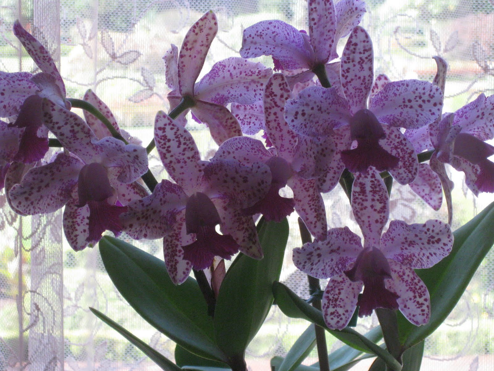
On the way back we made two stops: Charleston, a fishing village, and Shore Acres State Park, the former home of Louis J. Simpson. At the first we watched fishermen clean their catches, at the second we viewed formal gardens and an orchid show.

Freshly cleaned salmon


Our final excursion was to two boardwalks. From one we could see lumber being loaded on trucks and a freighter from Hong Kong. From the other, the view was more traditional.


The Oregon coast has a lot to offer.

Monday, October 4, 2010

Tillamook OR Sept 26-30

We had a campsite at Cape Lookout State Park that was a two minute walk from the beach. There were so many waves constantly crashing that at first we didn't recognize the sound. Ray thought it was a diesel engine running and I thought it was an airplane! The fog was different too. It rolled in at any time and simply stayed for half the day or more. (We considered ourselves lucky when it decided to roll out every once in a while.)

Our campsite

The beach and fog

On not so good weather days, we did some touring: the Tillamook Cheese Factory, Pacific Seafood (where we watched oysters get shucked) and the Air Museum, a huge wooden building that housed dirigibles during World War II.


When the weather cooperated, we enjoyed the beaches and the spectacular coastline. The Pacific City beach just south of us offered a 300 ft sand dune and some interesting rock formations. To paraphrase Dorothy: Toto, I've a feeling we're not in Virginia any more.

Our beach as seen from the day use area of the park

The sand dune at Pacific Beach


Me in front of one of the smaller formations


Ray pondering on the differences between east and west

Sunday, October 3, 2010

Cascade Locks OR Sept 23-26

We set off in the rain for the Columbia Gorge area. Our KOA campsite in Cascade Locks was very well kept, but noisy due to frequent train whistles.


At first it was cold


But we still made lots of excursions: we visited the Columbia Gorge Interpretive Center in Stevenson, WA, the Bonneville (Oregon) Dam and the Bonneville Fish Hatchery.

The fish wheel at the Interpretive Center, once used to catch boat loads of salmon.

The fish ladder at the Dam. This is a picture of real salmon fighting their way upstream.

Herman, the sturgeon (at the hatchery) who is close to 70 years old, 11 feet long and weighs almost 500 lbs.

When the weather cleared we drove the Historic Columbia Highway (old Rte 30)


seeing Multonmah Falls and views of the Columbia Gorge from Vista House at Crown Point, Memaloose Overlook and Rowena Crest Overlook.

The Falls

The view from Vista House


Memaloose Overlook from afar and,


to give an idea of scale, up close. The monument on the island center front is 13 feet tall.

A picture of us at Rowena Overlook

We took a detour to Panorama Point to see Mount Hood


and on the trip home we stopped at a festival and Ray observed closely how the local Indians smoke salmon.


Our entire stay at Cascade Locks was chock full of beautiful and informative sights.

Silver Lake WA Sept 20-23.

We drove to Silver Cover RV Resort and made it our base from which to explore Mount Saint Helens. Our site was on the water and several times we drove by deer on our way in and out of the campground.


We drove 52 miles to Johnston Observatory (5 miles from the Mount St. Helens crater) stopping at numerous look-out points. It was amazing to see what happened to the trees and how nature reshaped a landscape.


Some trees (see white) fell over dead from the blast, others still stand--they died from the heat but were protected from the blast by a ridge.

This tree was torn apart by the blast

These trees, caught in the slide, were buried

Mount St. Helens and the mud slide area already showing new growth

Both Ray and I found Mount St. Helens fascinating.

Bainbridge Island WA Sept 12-20.

We spent 8 days at our friend Mary Lynne’s home, leaving the trailer at Bainbridge Island Storage Facility. This visit was relaxation plus. We ate well, we slept well and we spent lots of time enjoying Mary Lynne and her friends. Meeting her grandson Eli was a special treat. (Sean impressed us as a very relaxed and competent dad.)

Mary Lynne, Eli (and Sean in the background)

We especially enjoyed Mary Lynne’s deck and the wildlife around it—bright colored hummingbirds who used the feeder even when we were on the deck and black and blue bluejays who expected peanuts every morning.

Bluejays waiting

We did only a little touring: We took Ollie (Mary Lynne’s friend Gabby loaned him to us) for a walk at Fort Ward State Park, we visited the Glass Museum in Tacoma, we toured downtown Poulsbo eating on a balcony overlooking the main street and we drove around the island to see the sights.

Ray and Ollie

Me at the Glass Museum

Ray on the balcony in Poulsbo

Seattle sky line (note Space Needle at the bow of the ship)


Thanks Mary Lynne for a wonderful 8 days.