For the number-crunchers in our group, after five months on the road we have added over 11,800 miles to the truck. With a combined towing and touring average of around 15 MPG, we have sucked up about 780 gallons of diesel fuel. If you estimate the cost of diesel at about $3.10 per gallon, you can do the rest of the math – with or without the assistance of some electronic device - to calculate the total fuel cost.
As many of you know, I believe you should always use an electronic device whenever it is within reach. I am reminded of the time when the moral dilemma on campus was whether or not a slide rule could be used during an exam. My thinking has always been “why waste time and brain power confirming what is already known”? If your goal is to explore and conquer the unknown, then you should move as quickly as possible through the known, using whatever mechanical device makes that possible.
The purist argument in the slide rule debate was that if the slide rule was broken or not available, humans might have to rely entirely on their brain. If we fast forward fifty years and apply the same logic to today’s way-more-advanced technology, than the question becomes whether or not I can use my laptop or iPhone. My response is of course the same, use technology.
If an electronic aid is not available to me, then I must be in some truly remote part of the world, where it really doesn’t matter if my hut has a perfect right angle. Or, it means we are all starting over, in which case we would need to reserve our brain power for far more urgent issues, such as how to get coconuts down from a very tall tree.
So, what does a moral dilemma have to do with recounting and recording our RV journey of a lifetime? Absolutely nothing; but, that is what is called “editorial privilege” – and precisely why this section of the blog is referred to as “Ray’s Ramblings”
I continue to have a wonderful time on our journey. I am certain that Debby is too because the other day we met a couple at a cocktail lounge and Deb asked them “Do you want to come to our house and play some Hearts?” Our HOUSE!!??? That is the way she and I both think of our portable home – with less than 300 square feet of living space.
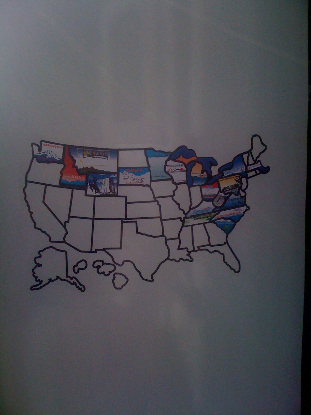
We are having so much fun that the trip will very likely extend into a full year – or more. We have too much of this great country yet to see. I am constantly reminded of how much we have not explored when I look at our new vanity map of the US, which has a brightly colored sticker representing each state where we have camped. It is a great ceremony each time we add a new state – and filling the white spaces is a very competitive activity among fellow campers.
Of course the map is always affixed in a conspicuous area on the outside of the trailer, so that it is visible to everyone and they can compare our map with the achievements of their own map. It is very rare indeed to see a map with all the states filled in, but we have seen a few. The RVs in these cases are apt to be very old and decayed – as are the owners.
Our map has the east coast pretty well filled in, as well as the north and northwest perimeter of the US. Looking down the road though, what I am seeing is a map at the end of this journey that will have a huge empty space, with Kansas or Oklahoma as the epicenter. Our current plan calls for heading for Texas after visiting our son Jeffrey in Nevada. We have been telling poor Jeffrey that we are “on our way” to see him for the last five months. After at least three weeks with Jay, Debby is thinking we will want to visit her sister in Florida. In this scenario, we will have to traverse the Gulf States – which mean more state stickers on our map!
Following the route I just described, you can see how we will have the huge white space in the center of our US map – staring out at other campers, reminding them we don’t have the intestinal fortitude to see ALL of the US. The only way to fill in the big white space on our map is to start planning a second voyage in our RV, which I think is what Debby is actually doing when she spends so much time on the laptop. As most of you know, I wear the pants in the family, but when it comes to RVing, all I do is connect the RV and drive. I am happy to drive any course that Debby and Jill have plotted. Jill, of course, is the Garmin GPS – one of our many electronic devices that is always within reach.

But I am here to enjoy the present moment and not dwell on plans that are so far away, right? So, let me tell you a little about the present.
As we make our way down the west coast, the continuing theme for me is the incredible diversity of the landscape. Every imaginable landscape is there for us to enjoy - and believe me, photographs never do justice to what we actually see. Within a space of less than 100 miles, you can go from rolling hills spotted with cows and sheep, to a 300 foot deep gorge with steep cliffs, crashing waterfalls, giant Cyprus trees, and a 15 degree drop in temperature.
All of us have at one time or another experienced the awe that comes from something like watching a sunset over the ocean. Now try to imagine five consecutive months of awe. Your jaw begins to hang away from your face permanently.
A typical example of “awe” was the recent sight of a 300 foot sand dune off the coast of Oregon – supposedly one of the largest in the world. It was so huge that as you approached it from about a quarter mile away, your entire field of vision was filled with the dune. It must be exactly the same perspective that an ant has. Even more surprising was that you could see tiny specks that appeared to be ascending the dune. Those little dots were actually people – it was just like trying to find Waldo!
With all the diversity in our nomadic life, the one constant is the RV. We are so happy to be living in the comfort of our familiar RV. I always know where the TV remote is, how to use the microwave, and where the beer is stored. It is very much like “home”!

 Notice the roads cut into the hills.


 Ray in front of the sequoias
 The Giant Grizzly from below
 The Giant Grizzly from afar
 Many of the trees looked dry and half dead
 Don Pedro Lake in the distance and approaching greenery
 This was the most ornate houseboat. It was named "Unorthodocks".


 Tomales Bay from the opposite shore


